There's a plan to make Bangkok's Old Town great again, but at what cost?
Is the BMA’s plan for Rattanakosin going to create a hub of heritage and culture? Or does the Old Town need rescuing from its supposed-saviors?
6 years ago


On Aug 27 this year, the Bangkok Metropolitan Administration (BMA) announced plans to revive its Rattanakosin conservation and development strategy, written back in 1997. The plan would see full-force preservation efforts take effect in Bangkok’s “Old Town.” The BMA’s regular Old Town commentator, Sakchai Boonma, director of the Land Acquisition Division, Public Works Department, came out to make comparisons between Rattanakosin—the area of Bangkok home to the Grand Palace, Wat Pho, Wat Mahathat and other monuments—and the Champs-Elysees, the historic axis of Paris.
But early warning signs show that the BMA’s idea of conservation may be at odds with existing communities in the area. Already, the controversial clearance of the Mahakan Fort community has seen old homes and trees bulldozed to make way for a sterile new public lawn unveiled to a chorus of social media groans in July—and Mahakan may just be the start.
As state agencies, including the BMA, the Interior Ministry and Tourism and Sports Ministry, are relocated in order to preserve Rattanakosin’s “historic” status, is the area in danger of losing all sense of community in pursuit of a sanitized version of history?
In charge of alleviating these fears are the academics of Chulalongkorn University’s Town Planning Department, who have been chosen to carry out the restructuring plan. Six years ago, they drew up the Bangkok Vision 2032 plan, an ambitious, 20-year running project to turn Bangkok into an even greater regional powerhouse with Rattanakosin’s historic status at its core.
Here, we look at those plans and ask those involved: are we doing what’s right for Bangkok
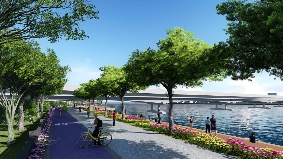
Originally announced back in 2015, the controversial river promenade will run along both sides of the Chao Phraya River from Rama 7 Bridge (in the north of Bangkok above Chatuchack Market) to Phra Pinklao Bridge (located between Phra Sumen Fort and Sanam Luang parade ground in the Old Town). In July 2017, the government demolished 14 communities that stood in the path of the promenade, with residents relocated to new accommodation. According to The Nation, the Rattanakosin and Old Cities Conservation and Development Committee has proposed that the promenade be shortened from its total 14-kilometer length (seven kilometers on each side of the river) to stop far outside the Old Town at Bang Sue canal. The BMA has yet to announce its conclusion.


Open since the evening of Jul 24, Mahakan Fort Park is the end result of a 59-year-long dispute between the local Mahakan community and the Bangkok Metropolitan Administration (BMA). After years of protests and refusals, the last of the residents—who claim their family lineage in the neighborhood dates right back to the early Rattanakosin Era, during the reign of King Rama III (1824-1851)—were evicted from the area in April 2018. This paved the way for the BMA to spend B69 million on launching a new public park. The dispute at Mahakan Fort dates right back to 1959, when the government bought back land from around Mahakan Fort in an effort to preserve the fort and its surrounding area from all but 11 owners who refused to sell. The model scheme to create parks in the Rattanakosin area came later, in 1978, followed in 1992 by the BMA’s royal decree to improve Rattanakosin’s urban planning—including the expropriation of land on which the Mahakan Fort community lived.
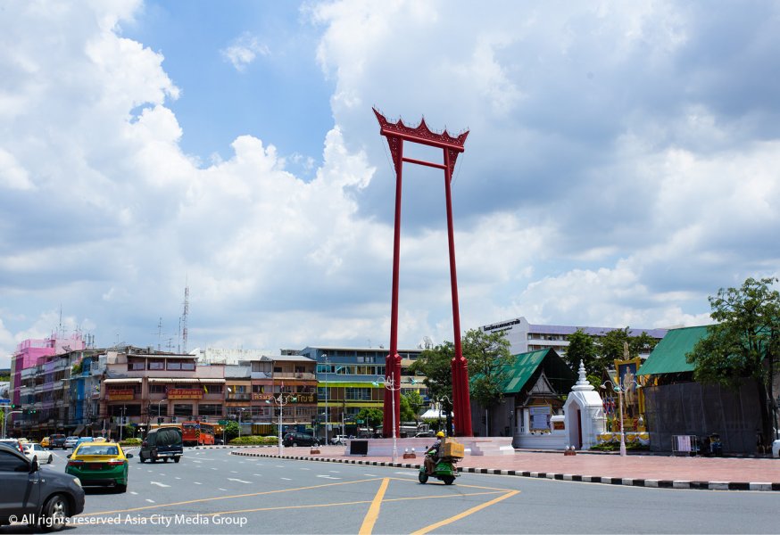 Sao Ching Cha
Bangkok’s first ever settlement, Rattanakosin Island dates back 230 years. The name “island” comes from the Chao Phraya River that runs along the area’s western border, and the Khlong Lot canal that completely rings its eastern perimeter. The area is home to over 51,000 permanent residents and over 19,000 homes. It’s also where Bangkok’s grandest historic monuments sit, including the Grand Palace, Wat Pho and Wat Mahathat.
Here’s what those who live and work in Rattanakosin think about how their neighborhood is changing.
“I’ve heard of the news for a while, but have not yet seen anything done to the area. I don’t think I’ll be affected. I can roll with change.”
Boontun Chantaroeng, tuk tuk driver

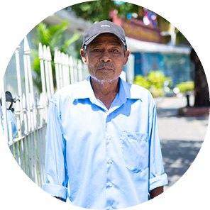
“We have invested a great deal into our businesses in this area and fear that the development plan will affect us a lot. My brother who’s also a street vendor around the Ministry of Interior has already been affected. I’m quite sure the same will happen to me.”
Amnaj Otatawong, street vendor

We used to have a big community until Mahakan Fort was turned into a park. It was hard see people you knew grew up here having to leave the area. They did get paid to leave, so that’s better than nothing.
Sunthorn Pothong, former Mahakan Fort resident

Dr. Siriwit Issaro
Assistant to the Bangkok Vision 2032 project consulting team
“The Rattanakosin conservation and development strategy is part of the 2032 project to develop culture and innovation over a 20-year development plan. Bangkok Vision wants to turn Bangkok into a travel center of Asia and to change the face of Rattanakosin town into a nicer, structured area. But to make it like the Champs-Elysees might not be as easy. We have to admit that there's still quite a lot that has to be done to make this project really work, like how we still lack discipline and how the climate here isn't exactly like that of Paris. Developing just an area but not as a whole, I think it will be hard."

Dr. Amorn Wanichwiwatana
Member of the Constitution Drafting Commission and lecturer at the Faculty of Political Science, Chulalongkorn University
“The plan itself is great if thinking in terms of lighter traffic, clean structures and approachable ways of traveling. The only part that seems to be lacking about this whole plan is any mention about managing the high-rise condos along the Chao Phraya River that have been standing since before building regulation was taken seriously. I personally think that if the Rattanakosin development plan is really to be carried out, then just as the ministries are being moved out to have buildings in the area fit the same architectural style, then those condos should be no exception.”
Advertisement